Skip to content
Donate
Weather
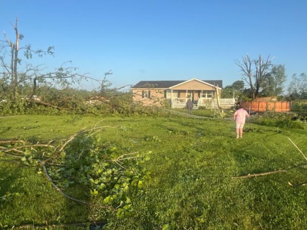
Grim toll tallied again after weekend tornado tears through some places hit in 2021
Liam Niemeyer
•
May 28, 2024
The storms were responsible for five deaths across Kentucky as neighbors in Hopkins County rely on each other to recover — yet again.
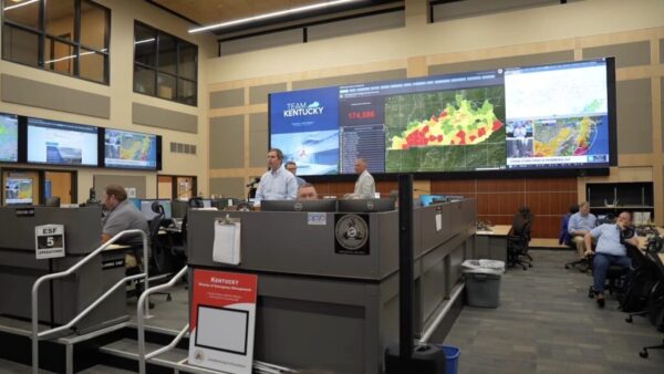
Beshear: 4 dead in Kentucky following lethal Memorial Day weekend storms
Derek Operle
•
May 27, 2024
The deaths include a 67-year-old woman in Mercer County, 62-year-old woman in Hardin County, 48-year-old woman in Hopkins County and a 34-year-old man in Jefferson County.
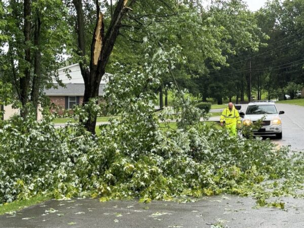
Utility crews work to restore power following severe storms in Hopkinsville, Christian County
Jennifer P. Brown
•
May 26, 2024
Downed trees and broken utility poles were reported in several areas of the city and county.
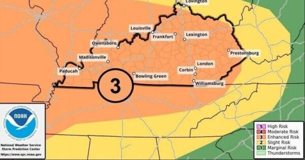
Severe weather possible in Kentucky until Thursday, entire state at enhanced risk
Tom Latek
•
May 7, 2024
The most severe storms are expected Wednesday afternoon and evening.
Tornado watch issued for Christian County
Hoptown Chronicle
•
April 2, 2024
The watch will remain in effect until 3 p.m. Tuesday, the National Weather Service said.
Dense fog advisory issued for Christian County
Hoptown Chronicle
•
January 24, 2024
Conditions could be a concern for drivers Thursday morning.
Christian County Public Schools remain closed
Hoptown Chronicle
•
January 21, 2024
The district anticipates students will return to schools Tuesday.
Wind chill advisory issued; low temps Friday and Saturday will be near zero
Jennifer P. Brown
•
January 19, 2024
The wind chill Friday will be as low as minus 10.
Winter weather advisory issued for Hopkinsville with threat of ice and snow
Jennifer P. Brown
•
January 18, 2024
The advisory is in effect from 10 a.m. Thursday through 9 a.m. Friday.
Most schools in Hopkinsville to remain closed Wednesday
Hoptown Chronicle
•
January 16, 2024
The region will get a brief mid-week break from the extreme cold but frigid temperatures will return Friday with gusting winds.
TVA is asking customers to conserve power Wednesday morning
Hoptown Chronicle and Kentucky Today
•
January 16, 2024
In a separate announcement, Pennyrile Electric said "power supplies are tightening" with extremely cold temperatures in the region.
After a marginal snowfall in Hopkinsville, biggest concern is frigid temperatures
Jennifer P. Brown
•
January 15, 2024
The wind chill factor will be below zero through Wednesday, and the National Weather Service has forecast the possibility of more snow on Thursday.
Posts pagination
Previous
1
…
6
7
8
…
16
Next