The tornado that struck South Christian County on Dec. 11 was on the ground for more than 122 miles and had peak wind speeds of 160 mph, according to preliminary data released by the National Weather Service in Paducah.
When it reached Christian County around 12:10 a.m. on Saturday, Dec. 11, initial findings indicate the tornado was an EF2. The rating appears to have remained the same until the funnel lifted just before reaching Elkton.
- RELATED: Christian County residents now eligible for FEMA disaster aid
- RELATED: Facebook group helping reunite Kentucky tornado victims with belongings
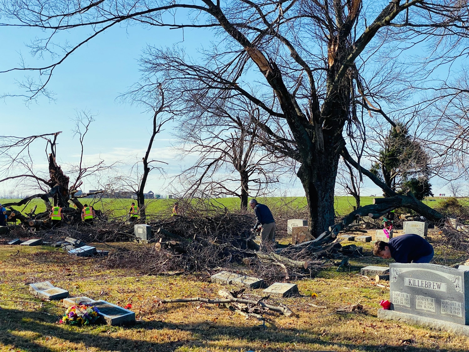
As the storm crossed through Christian County, it caused injuries to four people, caused millions of dollars in damage and destroyed several homes and outbuildings, according to the weather service’s report. It snapped numerous trees in half and damaged several headstones at Rosedale Cemetery on South Main Street.
When the tornado touched down again in Logan County around 12:45 a.m., it strengthened to an EF3 and continued to just before the William H. Natcher Parkway.
The storm’s path
The weather service’s preliminary report indicates the tornado took the following path:
The tornado that eventually battered South Christian County was first detected around 10:35 p.m. in Newbern, Tennessee. It moved northeast, continuing to strengthen to an EF3 as it approached Dresden, Tennessee, where several buildings were damaged or completely destroyed.
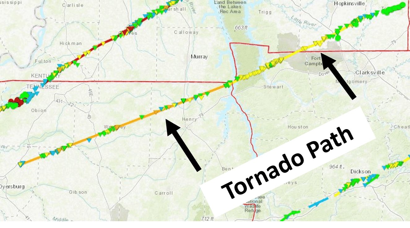
After clipping the Fort Donelson National Battlefield area in Calloway County, the tornado weakened as it crossed the Tennessee River and crossed into Land Between the Lakes. It continued northeast, through the far northwest corner of the Fort Campbell Army Base.
The twister entered southwestern Christian County, passing just south of LaFayette, Kentucky, where it struck a barn and knocked down several electrical lines. It traveled over mostly open county before causing significant damage to several homes off of Boddie Road and Darnell Road. It continued on to cause more significant damage to several homes, outbuildings and structures on Palmyra Road.
After destroying a mobile home on Herndon Oak Grove Road and four tobacco barns off Bradshaw Road, the tornado “took straight aim for the city of Pembroke,” where it caused significant damage to trees and buildings. As it continued out of the city, the tornado destroyed two mobile homes, injuring the occupants.
The tornado continue into Todd County, which saw mostly tree damage and damage to outbuildings, lifting just before reaching Elkton.
The funnel touched back down just east of the Todd and Logan county boundary, carving a path of destruction as an EF3 until just before the William H. Natcher Parkway.
The second of two long-track tornadoes
The tornado that swept across South Christian would have been an anomaly on its own. Most tornadoes stay on the — 3 to 4 miles on average. Long-track and very long-track tornadoes — those that travel at least 25 and 100 miles respectively – are relatively uncommon.
But two and a half hours earlier, a high-end EF4 that clipped the northwest corner of Christian County remained on the ground for more than 165 miles, according to the weather service. The earlier tornado carved a path of destruction that leveled much of Dawson Springs and Mayfield.
On Friday, the death toll from the storms was 77, and one person in Hopkins County was unaccounted for.
Julia Hunter is the engagement editor for Hoptown Chronicle. Reach her at julia@hoptownchronicle.org.