(This story has been updated to reflect the revised weather forecast.)
Hopkinsville residents began the week under a heat advisory and quickly shifted to an extreme heat warning with heat index values expected to range from 103 to 109 degrees.
Western Kentucky will experience “dangerously hot conditions” all week, according to the National Weather Service forecast.
Following Monday’s heat advisory, an extreme heat warning was issued for Tuesday morning through Saturday evening.
“A prolonged period of dangerously hot temperatures are expected this week,” an official with the NWS office at Paducah wrote in a Facebook post. “High temperatures may approach 100 degrees with heat index values approaching or exceeding 105 degrees! Be sure to check on the vulnerable population, check your backseat and take precautions if working outdoors this week.”
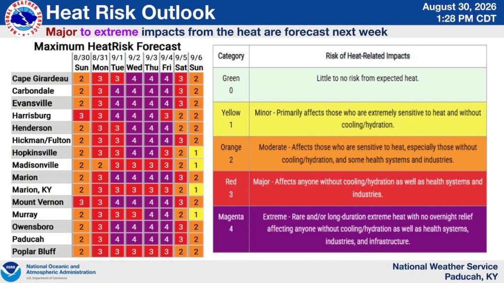
According to a “Health Risk Outlook” graphic, Hopkinsville will experience the most severe impacts on Wednesday and Thursday. This level means the city will see “extreme heat with no overnight relief.”
The NWW advises residents to, “Drink plenty of fluids, stay in an air-conditioned room, stay out of the sun, and check up on relatives and neighbors.”
A heat advisory means dangerous heat is in the forecast while an extreme heat watch means potentially life-threatening heat is possible that could require limits to outdoor exposure.