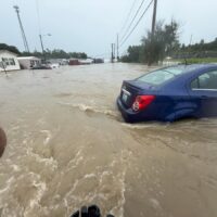
More than three months after the December tornado outbreak, the National Weather Service’s Paducah office scientists held a workshop on the science of the storm and information messaging around the Dec. 10 disaster.
NWS officials spoke at a Severe Weather Workshop Thursday at Murray State University’s Paducah campus, covering the science of the tornado outbreak, the teamwork within the Paducah office and the steps taken by the office in the aftermath.

Pat Spoden, a science and operations officer with NWS, led a session on the advanced forecasting and warnings. He said the short-term models for that evening ran the gamut – some showing no storms at all, others presenting lines of storms and others still warning of a popcorn-like smattering of powerful storms across the area.
“Personally when I came in that day, that’s kind of what I was expecting was several storms, maybe in somewhat of a line, but several supercells, each one of them probably capable of producing a tornado,” Spoden said. “I did not expect a single storm to take over, and in fact, there were actually two that evening that really took over.”
Spoden said some of the things they were looking at ahead of the event were the surface flow over Missouri and a very long warm front. He remembered the humidity he had felt when he was out in his neighborhood earlier that day and knew that warned of weird weather. High temperatures and a high dew point in December and January are signs the NWS shares with communities as something to keep an eye on for potentially dangerous weather.
“I’m walking around the neighborhood going, there’s probably going to be a neighborhood that’s not going to be here tomorrow, cause it’s just one of those eerie feelings that you have as a forecaster,” Spoden said.
On the day of the outbreak, tornado warnings were issued from Arkansas all the way to the southside of Chicago as major cells crossed through the Little Rock, Memphis, Paducah, Fort Campbell and Louisville NWS offices’ radars. One radar image Spoden displayed had a peculiar characteristic, a three-body scatter spike, normally indicative of hail, that showed some of the debris being read by the radar.
Spoden also talked about how people will be researching aspects of the outbreak for a long time, one thing specifically being how the early warnings and storm messaging was effective.
“Every time you go out and you talk to somebody or you’re on the air talking to somebody about what you should do when the big one comes, that’s what people did,” Spoden said. “How many people survived by being in storm shelters, being in the basement, being in bathtubs, putting on helmets? They did all that stuff. We’ve been talking about that for 40 to 50 years, and what made me feel good is that it works.”
Spoden said as the storm advanced into the Paducah region, he struggled with when to issue storm warnings because issuing them too far in advance might cause people to leave shelter before a storm event arrives.
“The concern is how long is too long of a lead time,” Spoden said. “To a person, if they go into a storm shelter, as soon as that tornado warning is issued, which is what we teach them to do, and 15 minutes later, nothing has happened, they come out.”
The first warning was issued for Fulton and Hickman counties that day. Spoden said he didn’t initially issue a warning for Graves County because, at the time of the first warning, he could only cover half the county. Additionally, he could only use certain language for certain areas to describe the storm’s potential – specifically “considerable” for rural areas and emergency language for populated areas such as Mayfield.
He said his first warning for Graves County was a little too long that night.
“Basically, we embedded a tornado emergency inside another warning to highlight our last chance to stand up and scream for Mayfield saying, ‘Take shelter now, if you’re not, you don’t it’s going to be very bad,’” Spoden said.
He described the way things worked in the Paducah office that night as “a true team event” which, he said, doesn’t always happen. He went home at midnight that night.
“I really didn’t know what happened. I don’t think many of us did until unless you were in Mayfield or you’re in the other communities,” Spoden said. “You just think okay, it was bad. We knew about Mayfield when I went home, and we knew it was going to go through Dawson Springs and those areas, but you really don’t know what it is until the next day.”
Lily Burris is a features reporter for WKMS. She has a bachelor's degree in journalism from Western Kentucky University. She has written for the College Heights Herald at WKU, interned with Louisville Public Media, served as a tornado recovery reporter with WKMS and most recently worked as a journalist with the Kentucky Center for Investigative Reporting. In her free time, she enjoys reading, crocheting and baking.