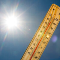
Hopkinsville will be under an ice storm warning from midnight Tuesday through 6 p.m. Thursday with the possibility of ice accumulation from two-tenths to one-half inch.
The highest amounts of ice accumulation will occur “along the southern portions of the Kentucky Pennyrile and Purchase” regions, the National Weather Service said. “Additionally, up to a quarter inch of sleet is possible Thursday.”

The NWS forecast says, “Power outages and tree damage are possible due to the ice. Hazardous travel conditions are expected and could impact the morning or evening commute.”
Between Thursday and Saturday, wind chills will plunge to the teens and single digits, followed by the possibility of dangerous wind chills below zero on Sunday, the NWS reported.
The NWS originally issued a winter storm watch but upgraded the forecast Tuesday to an ice storm warning.
More detailed, daily NWS forecasts for Hopkinsville include:
- Tuesday night — A slight chance of rain between 11pm and midnight, then a chance of freezing rain. Cloudy, with a low around 31. North northeast wind 6 to 8 mph. Chance of precipitation is 40%.
- Wednesday — A chance of freezing rain before 9am, then rain likely. Cloudy, with a high near 36. Northeast wind around 7 mph. Chance of precipitation is 60%. New ice accumulation of less than a 0.1 of an inch possible.
- Wednesday night — Rain before 10pm, then freezing rain between 10pm and 4am, then freezing rain, possibly mixed with sleet after 4am. Low around 27. North northeast wind 7 to 10 mph. Chance of precipitation is 80%. New ice accumulation of 0.1 to 0.3 of an inch possible. Little or no sleet accumulation expected.
- Thursday —Sleet, possibly mixed with freezing rain, mainly before noon. High near 33. North northeast wind 9 to 11 mph. Chance of precipitation is 80%.
- Thursday night — Cloudy, with a low around 22. North wind around 9 mph.
- Friday — Partly sunny, with a high near 31. North wind 10 to 13 mph.
- Friday night — Mostly cloudy, with a low around 18. North wind around 10 mph.
- Saturday — Mostly cloudy, with a high near 29. North wind 9 to 11 mph.
- Saturday night — A slight chance of snow showers before midnight. Mostly cloudy, with a low around 8. North wind 9 to 13 mph, with gusts as high as 18 mph.
- Sunday — Mostly sunny, with a high near 20. North northwest wind around 14 mph, with gusts as high as 22 mph.
- Sunday night — Mostly cloudy, with a low around 6. North wind 9 to 11 mph, with gusts as high as 20 mph.
On nights when the wind chill is forecast to be below 20 degrees, the Salvation Army of Hopkinsville provides its Extreme Weather Event warming station, better known as EWE, in the soup kitchen.
Anyone needing a warm place to stay overnight can enter the soup kitchen at the Eighth Street entrance, between Liberty and South Clay streets, starting at 7 p.m. Cots are sets up, and snacks are provided.
The Salvation Army regularly updates its Facebook page when the agency plans to offer an overnight EWE shelter. Additional information is available by calling Alisa Barton, 270-885-9633, at the Salvation Army during regular business hours.
Jennifer P. Brown is co-founder, publisher and editor of Hoptown Chronicle. You can reach her at editor@hoptownchronicle.org. Brown was a reporter and editor at the Kentucky New Era, where she worked for 30 years. She is a co-chair of the national advisory board to the Institute for Rural Journalism and Community Issues, governing board past president for the Kentucky Historical Society, and co-founder of the Kentucky Open Government Coalition. She serves on the Hopkinsville History Foundation's board.