The National Weather Service continues to warn Kentuckians that severe weather of all types, including tornadoes, strong winds, large hail and heavy rain, are all possible until sometime during the day on Thursday.
John Gordon, who heads the National Weather Service office in Louisville, says the entire state is in an enhanced risk for severe weather, especially Wednesday and Wednesday night.
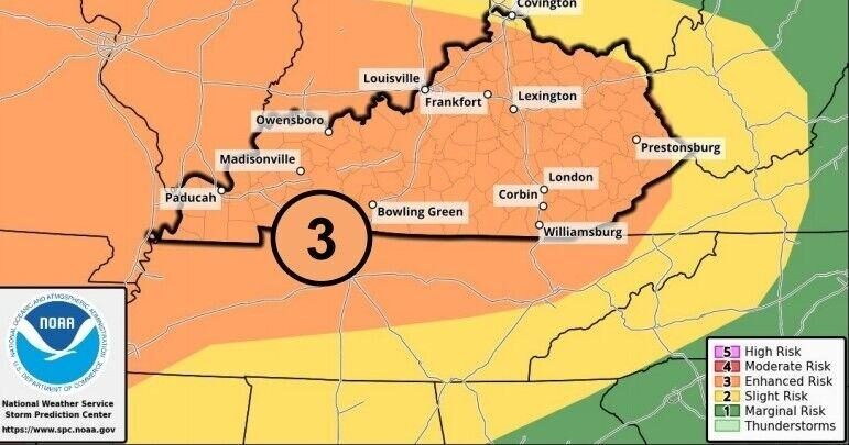
“There is great instability to our Southwest down in Tennessee, Arkansas and Mississippi,” Gordon said during an online briefing Tuesday afternoon. “The amount of cloud cover we have is the key to the potential for strong tornadoes to develop. If I was to pick an area that has the greatest risk for severe weather, it would be south of the Western Kentucky and Bluegrass Parkways.”
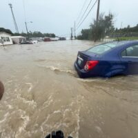
He also noted that the threat of flooding due to the storms is increasing. “Minor flooding on the Green River and Kentucky River basins, depending on how the rain falls.”
While the Weather Prediction Center places Kentucky in a slight risk area for flooding, Gordon said that may be increased on Wednesday.
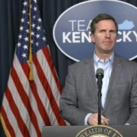
Gov. Andy Beshear is also asking Kentuckians to remain weather aware.
“Our number one priority is to make sure everyone stays safe,” he stated. “We know severe weather can come on very quickly, and with the possibility of tornadoes and flash flooding in the forecast, we need everyone to take action now by making a plan to keep you and your family safe.”
The governor said his administration is preparing. “Our Kentucky Emergency Operations Center has been activated and essential partners stand ready to provide support as needed.”
He also ordered closed executive branch offices closed on Wednesday at 2 p.m., as the peak time for severe weather is forecast to begin around that time.
Eric Gibson, director of the Kentucky Division of Emergency Management, stated, “If you experience damage to your home or property, please document that and report that before beginning any of the cleanup efforts. This will be vital for the recovery assistance programs that are available and for improving future preparedness.”
Kentucky Transportation Cabinet State Highway Engineer James Ballinger added, “Safe driving practices protect you, first responders and others on the road. Remember to never drive through flooded roads or over downed power lines, and slow down during periods of high winds.”
For severe weather preparedness tips, visit kyem.ky.gov.
This story is republished with permission from Kentucky Today. Read the original.

Tom Latek has been the Frankfort correspondent for Kentucky Today, the online news website of the Kentucky Baptist Convention, since 2016. Previously, he covered news for radio and television stations in Frankfort, Lexington, and Louisville.