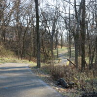
Natural disasters might strike indiscriminately, but the long term damage of extreme weather events isn’t felt evenly from place to place.
This is something my colleague, Ilana Newman, and I discussed in last Thursday’s episode of Getaway, a Daily Yonder podcast about rural recreation economies. In rural towns where recreation and tourism dominate the local economy, melting snow, increased smoke from wildfires, or polluted streams can significantly hurt the local industry.
Some of these rural areas don’t have other economic industries to fall back on in a bad snow year, for example, so they can be particularly harmed by the consequences of a changing climate. To add to that, many poor and rural communities don’t have the resources and tax base to sustain long term recovery from natural disasters on their own.
You can listen to that episode of Getaway wherever you get your podcasts. But in this week’s edition of the Rural Index, I decided to explore this phenomenon at the county level by using a measurement called the Social Vulnerability Index, or SVI, a tool that helps researchers assess the likelihood that a community will be disproportionately harmed by a natural hazard.
The Federal Emergency Management Agency (FEMA), which includes the SVI in their Natural Risk Index, a dataset that aims to identify communities most at risk of natural hazards, assigns all U.S. counties into one of five categories – Very High, Relatively High, Relatively Moderate, Relatively Low, and Very Low.
(Counties in the Very High category have an SVI percentile ranking between 80 and 100, meaning they rank higher in social vulnerability than 80–100% of all other counties. A county with an SVI score of 80, for example, indicates that 80% of counties have a lower SVI score. Counties in the Relatively High category fall between the 60th and 80th percentiles.)
To calculate SVI percentiles, the SVI takes into account characteristics like poverty rates, housing insecurity, transportation accessibility, and unemployment rates, just to name a few.
For the sake of this newsletter, let’s just take a look at the two most vulnerable categories – Very High and Relatively High. What is the geographic breakdown of these categories?
A greater percentage of nonmetropolitan, or rural, counties are in the Very High category compared to metropolitan counties. Twenty-two percent of rural counties are in the Very High category, compared to only 16% of metropolitan counties.
About an equal share of metropolitan and nonmetropolitan counties were in the Relatively High category–20% and 21%, respectively.
But social vulnerability varies more by region than rurality. In the South, for instance, 45% of rural counties are in the Very High category, while 31% are in the Relatively High category. That’s likely because two historically distressed regions are located primarily in southern states–the Black Belt and rural Appalachia.
In the last edition of the Rural Index, I described how the legacies of slavery, racism, and natural resource extraction in the Black Belt and rural Appalachia cause poverty, higher Medicaid participation, and lack of access to broadband internet, among other things. Some of those same trends contribute to higher social vulnerability in this region as well.
Out of the top 20 counties with the highest SVI score, 17 were in the South. The three others were in Virginia (which the Census puts in the Mid Atlantic region), New Mexico, and Oregon.
Take a place like rural Dallas County in central Alabama, for example. On the SVI, it’s in the 91st percentile, meaning that Dallas has a higher SVI score than 91% of all other U.S. counties. Dallas County is home to about 36,200 residents. In 2023, the poverty rate in Dallas was 31%. The national poverty rate was 11% that year.
The rural Southwest, where 35% of counties are Very High on the SVI score, is the second most vulnerable region after the rural South. Only 15% of rural Southwestern counties are in the Relatively High category.
In Hidalgo County, New Mexico, where the greatest natural hazard threat are wildfires, the SVI score was in the 94th percentile. In the southwestern corner of New Mexico, Hidalgo County borders both Mexico and Arizona. In 2023, the population of Hidalgo was just over 3,900 and the poverty rate was 24%.
Places like Hidalgo County might have a harder time securing the funds and resources to recover from a natural disaster compared to nearby metro areas, like Phoenix, Arizona, where the poverty rate is 14% and the tax base is larger (1.6 million residents).
The Social Vulnerability Index is one more way of showing us that place matters when we talk about the relative resilience of American communities. And as is frequently the case, rurality is an important factor in that analysis.
This story is republished with permission from The Daily Yonder. Read the original.