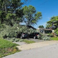
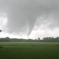
National Weather Service meteorologists say western Kentucky and northwest Tennessee could see a potential flooding threat the night of New Year’s Eve, which could be exacerbated by tornado debris in impacted areas. Much colder temperatures are expected to follow the rainfall as well.
Most of the region could see at least 2 inches of rain Friday night, with some areas including Graves County, Fulton County, Marshall County, Calloway County and Obion County, Tenn., seeing as much as four inches of rain.

National Weather Service Meteorologist Mike York said the spring season traditionally has greener vegetation and better evaporation due to warmer temperatures, which helps absorb rainfall more easily. But that isn’t the case now
“When we have that kind of rainfall in the wintertime, it tends to not runoff very well,” York said. “There could be rapid rises in streams.”
He said flood-prone roads are especially vulnerable. Tornado debris in some impacted areas could potentially worsen flash flooding. The National Weather Service recommends turning around when approaching a flooded road.
Meteorologists expect a significant fall in temperatures, as much as 60 degrees in some areas, to follow the rain. Lows in much of western Kentucky will be in the low 20s Saturday night.

York said wind chills could be in the teens in tornado-impacted areas Sunday morning. The colder temperatures aren’t expected to stay, with temperatures in the mid-50s by the middle of next week.
“That’s going to be a shot to the system, and for most of us, it won’t be that big of a deal,” York said. “But for those who were affected by the tornadoes and have no heat, obviously that will be a problem.”
York said there is an isolated chance of severe weather for parts of western Kentucky, though the areas most at risk are farther south, in Tennessee, Mississippi and Alabama. He said there is still low confidence in the forecast regarding severe weather, and those in the region could check for updates in the coming days.
Liam Niemeyer is a reporter for the Ohio Valley Resource covering agriculture and infrastructure in Ohio, Kentucky and West Virginia and also serves Assistant News Director at WKMS. He has reported for public radio stations across the country from Appalachia to Alaska, most recently as a reporter for WOUB Public Media in Athens, Ohio. He is a recent alumnus of Ohio University and enjoys playing tenor saxophone in various jazz groups.


