The United States Geological Survey says low-level airplane flights are planned in portions of Kentucky and five other states over the next six months, using airborne geophysical technology to modernize geologic information.
Flights will cover parts of western and central Kentucky, southeast Missouri, northeast Arkansas, northern Tennessee, eastern Illinois and southern Indiana. Up to five aircraft may be active at one time over the course of the survey. The flights will be based out of Paducah, Kentucky; Jonesboro, Arkansas; Gallatin, Tennessee; and Sellersburg, Indiana. See the map that accompanies this story for more precise survey locations.
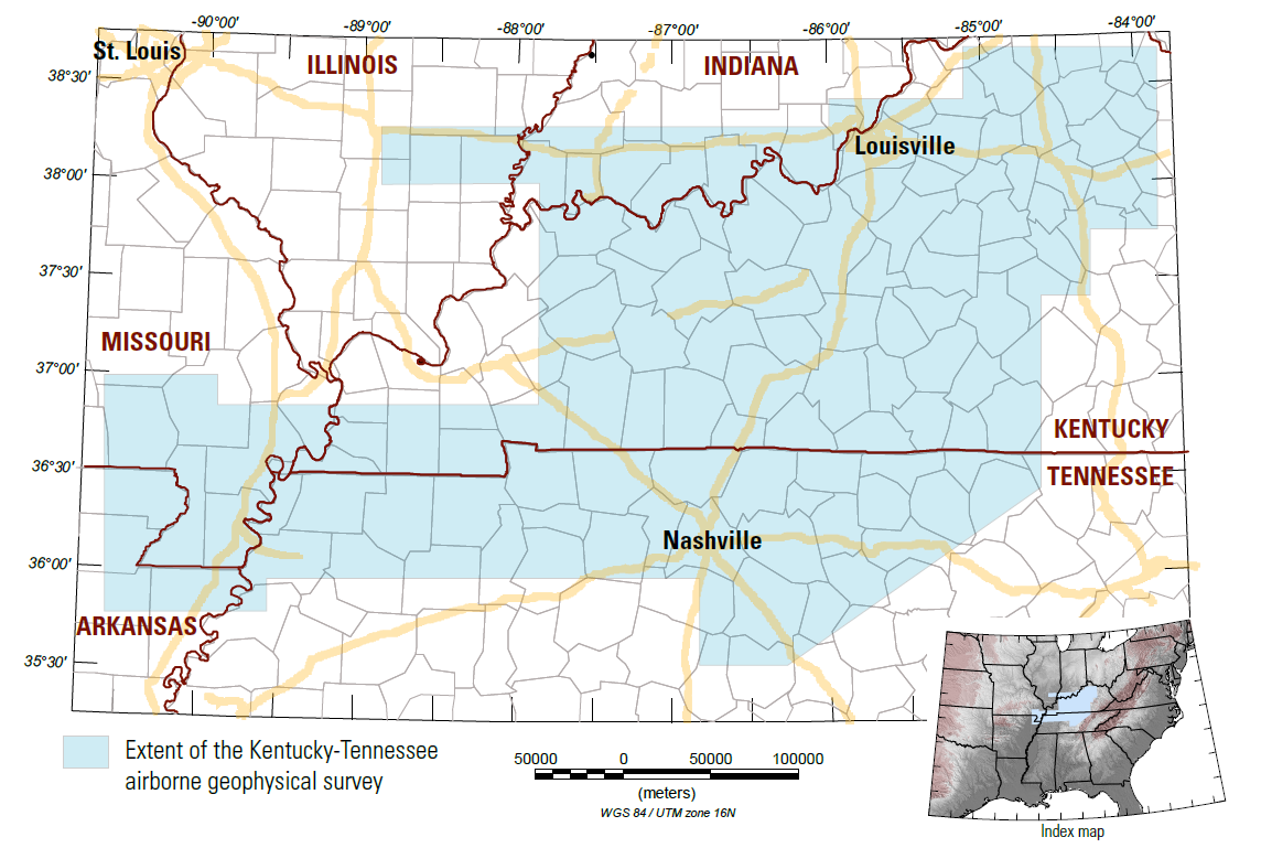
This effort will feature airborne geophysical surveys to map parts of the midcontinent along the Kentucky-Tennessee magnetic anomaly. This anomaly, first identified by satellite in the 1980s, has numerous mineral resource deposits around its edges. In addition, the survey will cover parts of areas related to the New Madrid and Wabash Valley seismic zones. The geophysical data will help to shed light on potential natural hazards in the region.
The new data gathered during the flights will be processed to develop high-resolution three-dimensional representations of bedrock composition and structure to depths more than 3,280 feet below the surface.
The 3D models and maps are important for improving our understanding of critical mineral resource potential, water resources, groundwater pathways near legacy mining areas, parameters for infrastructure and land use planning, and potential risks of naturally occurring radon.
The airplanes will fly along pre-planned fight paths relatively low to the ground at about 300 feet above the surface. The ground clearance will be increased to 1,000 feet over populated areas and will comply with Federal Aviation Administration (FAA) regulations. Flights will follow flight lines spaced about 1,300 feet apart.
The survey will use Piper Navajo aircrafts equipped with an elongated “stinger” mounted to the back of the aircraft. Instruments in the stinger and inside the cabin will measure variations in the Earth’s magnetic field and natural low-level gamma energy created by different rock types.
The scientific instruments on the planes are completely passive with no emissions that pose a risk to humans, animals, or plant life. No photography or video data will be collected.
This is part of a broader effort by the USGS to modernize understanding of the nation’s fundamental geologic framework and knowledge of mineral resources.
More information on USGS mineral resources research can be found here.
This story is republished with permission from Kentucky Today. Read the original.

Tom Latek has been the Frankfort correspondent for Kentucky Today, the online news website of the Kentucky Baptist Convention, since 2016. Previously, he covered news for radio and television stations in Frankfort, Lexington, and Louisville.