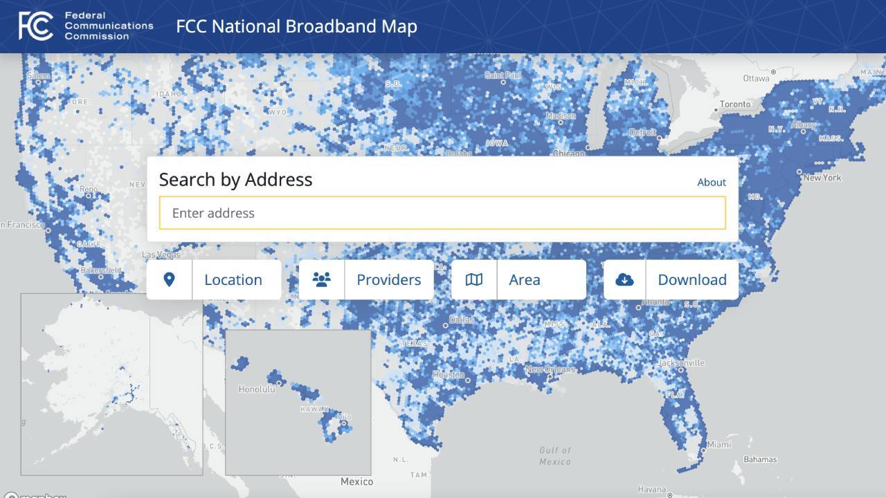
Gov. Andy Beshear is encouraging Kentuckians to challenge the accuracy of a new federal broadband availability map that will help determine how billions of federal dollars for broadband deployment will be allocated among states.

The Federal Communications Commission in November released a proposed online interactive map that lists available internet providers and the maximum advertised internet speeds from those providers for individual addresses of residences, businesses and other locations across the country. The map also includes the type of broadband technology each provider uses for reaching each address, such as fiber, cable or satellite-based internet.
The FCC is accepting challenges to fix inaccuracies for the new map until Jan. 13 based on location and internet provider availability. Such inaccuracies include if an address is inaccurate or missing on the new map or if a listed internet provider doesn’t actually serve a particular household or business.
“Access to high-speed, reliable internet service is vital infrastructure as critical to our connectivity as roads and bridges,” Beshear said in a statement. “But we must pinpoint where access is most needed to ensure we invest these dollars wisely. That’s why reviewing this FCC map is so important.”
Online users of the map can search for their address and click on “Location Challenge” or “Availability Challenge” through the online interface to fix inaccuracies.
Users of the map can submit challenges if the advertised internet speed a provider lists doesn’t match the actual speed received, but such challenges will be considered instead as a consumer complaint to the FCC.
This new map is an update of a previous version that showed only internet providers and advertised speeds for each census block, the smallest geographical unit used by the U.S. Census Bureau, something that broadband expansion advocates have criticized as inaccurate. For example, if an internet provider said it provided internet access to just one house in a census block, the old map would mark all homes in an entire census block as served by the provider.
Fixing inaccuracies in the new map could improve it and help determine how much funding from the federal Broadband Equity, Access and Deployment (BEAD) program that Kentucky receives. The BEAD program was launched through the passage of the Bipartisan Infrastructure Law in 2021, doling out more than $40 billion to expand broadband access across the country.
Kentucky received an initial $100 million from BEAD to boost each state’s coordination with local communities in planning broadband deployment, but how much additional funding the state gets to build broadband connection is determined in part by how many “unserved” locations a state has. Under BEAD, a home or business is considered “unserved” if it has no access to broadband or lacks access to internet speeds above 25 megabits per second download and 3 megabits per second upload.
Legislation passed with bipartisan support in the Kentucky legislature the past two years has allocated $300 million in federal funding from the American Rescue Plan Act toward broadband deployment in the state. The state has so far given out some of that funding through a first round of grants for broadband deployment to electric cooperatives and local governments. The lion’s share of that funding round went to Charter Communications, one of the largest cable companies in the country.
Meghan Sandfoss, executive director of the Kentucky Office of Broadband Deployment, said in a statement Kentuckians participating in the challenge process for the map will help make sure the state receives its “fair share of funding” through the BEAD program.
“Today’s debut marks the start of the public’s ability to offer challenges as well. The FCC has asked for challenges to the map data to be submitted between now and January 13, 2023, so that corrections can be included in a finalized version of the map.”
The final version will be used to set funding allocations for the BEAD program in summer 2023.
While the FCC will continue collecting crowdsourced speed data for fixed speeds, that data is not part of the challenge process. Rather, the map is relying on maximum available advertised speeds.”
Kentucky Lantern is part of States Newsroom, a network of news bureaus supported by grants and a coalition of donors as a 501c(3) public charity. Kentucky Lantern maintains editorial independence. Contact Editor Jamie Lucke for questions: info@kentuckylantern.com. Follow Kentucky Lantern on Facebook and Twitter.
Liam Niemeyer covers government and policy in Kentucky and its impacts throughout the Commonwealth for the Kentucky Lantern. He most recently spent four years reporting award-winning stories for WKMS Public Radio in Murray.


