In the weeks following Kentucky’s first confirmed case of coronavirus, public health officials placed an increased emphasis on social distancing to reduce the spread of COVID-19. Gov. Andy Beshear encouraged the practice as early as March 7.
But how well are residents adhering to the recommendations?
Location data recently released by Google, which compares community movement between Feb. 16 and March 29 to a five-week period earlier this year, provide some insight.
Report reveals Christian County distancing rates below state, national average
According to the data, visits to retail and recreation sites in Christian County declined 21% between Feb. 16 and March 29. There were 34% fewer visits to workplaces and 8% fewer visits to groceries and pharmacies. Time spent at residential locations increased by 16%.
There was not enough data to provide an analysis of activity from area parks or transit stations.
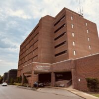
The release of Google’s COVID-19 Community Mobility Report, which pulls cell phone data from users who’ve enabled their location history, shows that social distancing measures in Christian County fall below state and national averages for the time period analyzed.
Kentuckians social distancing less than other states, data shows
Kentucky ranked low in a state-to-state comparison of the reduction in visits to retail and recreation spots. The only states that showed fewer changes to retail and recreation visits were Arkansas (29%), Missouri (38%), South Carolina (38%), Virginia (39%) and West Virginia (38%). Wyoming saw the same decrease in such visits, at 37%.
| Mobility Trend | Kentucky | Nationwide |
|---|---|---|
| Retail & recreation spots | -37% | -47% |
| Workplaces | -34% | -38% |
| Groceries & pharmacies | -11% | -22% |
| Parks | +68% | -19% |
| Transit stations | -34% | -51% |
| Residential | +9% | +12% |
The District of Columbia saw the most significant change in this category, with a 64% decrease, followed by New York and Vermont, which both showed a decrease of 62%.
Google’s public release of the information, which is typically used to show how busy certain businesses are at various times throughout the week via Google Maps, aims to help public health officials manage their response to the ongoing public health crisis. The company says it plans to make the aggregated, anonymized data available for a limited time — so long as public health officials find them useful in the fight against COVID-19.
Google isn’t the only major tech company using big data to combat the coronavirus pandemic. Facebook’s Data for Good program is making disease prevention maps available to researchers and nonprofits and has teamed up with Carnegie Mellon University to start gathering data from users experiencing symptoms. Researchers at Johns Hopkins University have utilized publicly geotagged Tweets to create the Twitter Social Mobility Index.
Julia Hunter is the engagement editor for Hoptown Chronicle. Reach her at julia@hoptownchronicle.org.