There is a threat of severe weather with the possibility of tornadoes and damaging straight-line winds across much of Western Kentucky on Monday and early Tuesday, the National Weather Service at Paducah warned.
The NWS issued a tornado watch, which is in effect until 11 p.m. Monday.
The forecast indicates showers and thunderstorms are likely beginning in the afternoon, and winds could gust as high as 30 mph.
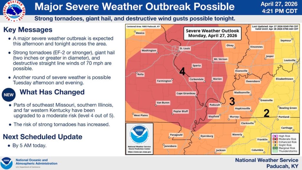
As of Monday afternoon, a NWS map of the enhanced risk of severe storms put Hopkinsville and most of Christian County at Level 3, meaning an enhanced risk, on a scale of 1 to 5.
This story was updated Monday afternoon to include the issuance of a tornado watch and new risk map from the National Weather Service.
Hoptown Chronicle is an independent, nonprofit news outlet that is dedicated to providing fair, fact-based reporting for people who care about Hopkinsville, Kentucky. We believe that public service journalism serves the community's social, cultural and economic wellbeing by fostering knowledge, connection and meaning.